Poland on a unique old map from around 1300. Map from Hereford - this is what the world looked like over 700 years ago in the work of cartographers at the time. What interesting information does this medieval map of England hide about our region? Where is Poland located on the map from Hereford?
Map from Hereford
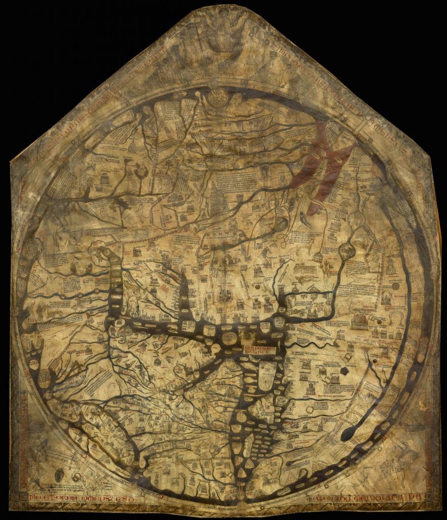
The so-called Hereford map is one of the medieval mundi maps. This type of map was characterized by a layout representing the entire world known at that time in the form of a circle surrounded by an ocean. In the center of the maps mundi was the Middle East. The map below is from around 1300. It was developed in England and its authorship is attributed to a certain Richard of Haldingham and Lafford. It was drawn on a piece of calfskin measuring 158 × 138 cm. The fact that it was entered on the UNESCO Memory of the World List proves how valuable this monument is. It is currently kept in a cathedral in the English town of Hereford, from which it was derived its name.

Map of Hereford - Medieval World Map from 1300
The full resolution Hereford map (4606 × 5355) is available at this link.
How to read the map?
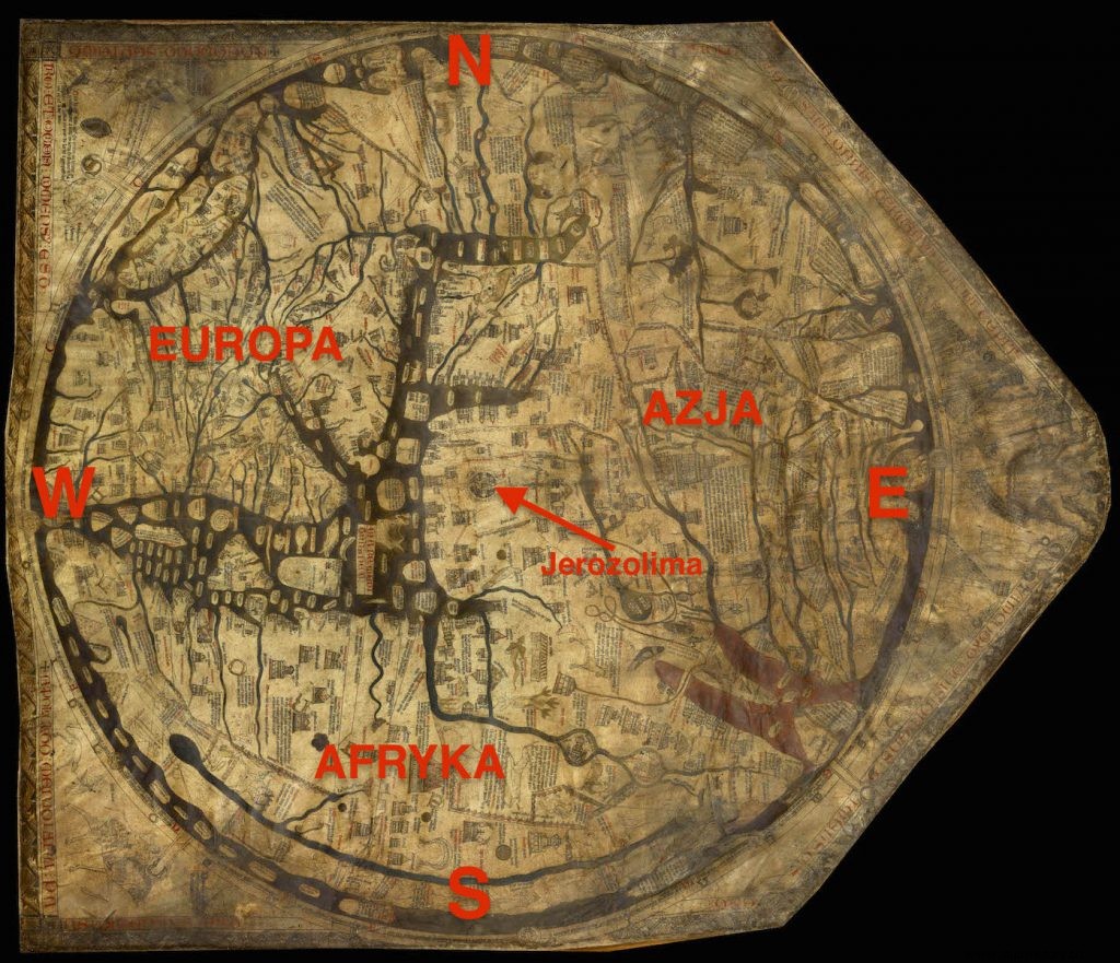
First of all, unlike modern maps, the Hereford map is oriented towards the east. This means that we have east at the top of the map, not north as usual. Jerusalem is exactly in the middle of the map. The shapes and proportions of the continents are strongly disturbed, and their course should be treated only schematically. The well-known areas around the Mediterranean are exaggerated and, again, the lesser-known continental fringes are flattened or wrinkled. In addition, on the map we can see numerous figures resembling creatures from mythology rather than a scientific picture of the world. Here is a schematic description of the map when rotated right.

Hereford Map Overview - Map rotated to point North on Top
Poland on the map from Hereford
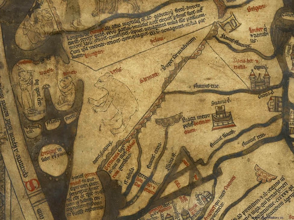
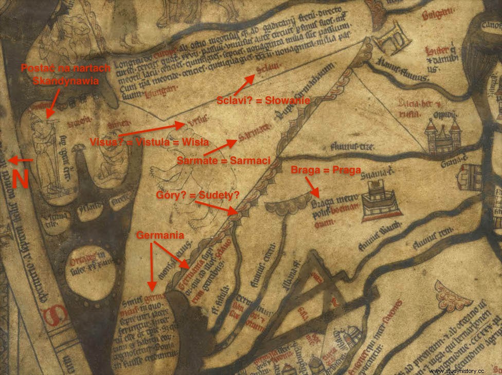
And here is a fragment of the map on which the territory of modern Poland is located. Let me remind you that at the time of creating the map, the Piast state was in the period of the so-called regional breakdown. However, we will not find much information about him. It should be emphasized that the content of the then maps left much to be desired. First of all, the state of knowledge contained on the map was far from what was actually available to people living at that time. In other words, it did not fully reproduce it, and the knowledge of the entourage then was certainly much better. The map has a lot of descriptions. Unfortunately, most of them are unreadable to me. However, I managed to read a few words. If anyone else can read something, feel free to leave a comment.

A fragment of the map from Hereford in the place where Poland is located

Central Europe and Poland area on the map from Hereford - Some of the words and pictures that I have managed to read
