The abbey of Saint Gall (in German Sankt Gallen) was founded in the year 613 in the town that today bears his name in Switzerland by an Irish monk, Gallus of Hibernia. It would be one of the main Benedictine monasteries in Europe for many centuries.
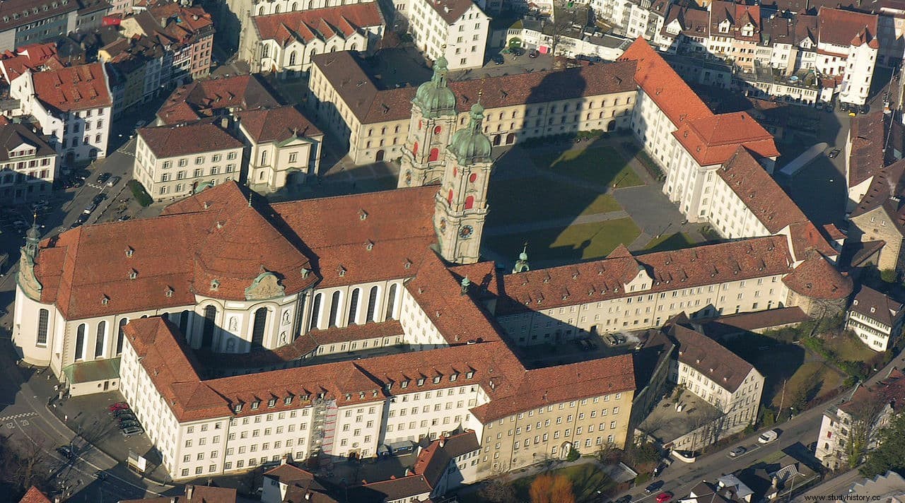
It flourished under the patronage of Pepin the Short and his son Charlemagne as a center for the study of arts and sciences, and came to house an important library of manuscripts that monks from all over the continent came to copy. The funds are still preserved and, with its almost 160,000 volumes, it constitutes the oldest collection in Switzerland. The current room, built in the 18th century, is considered one of the most beautiful libraries in the world.
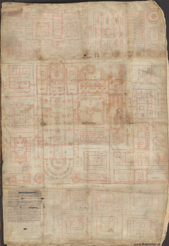
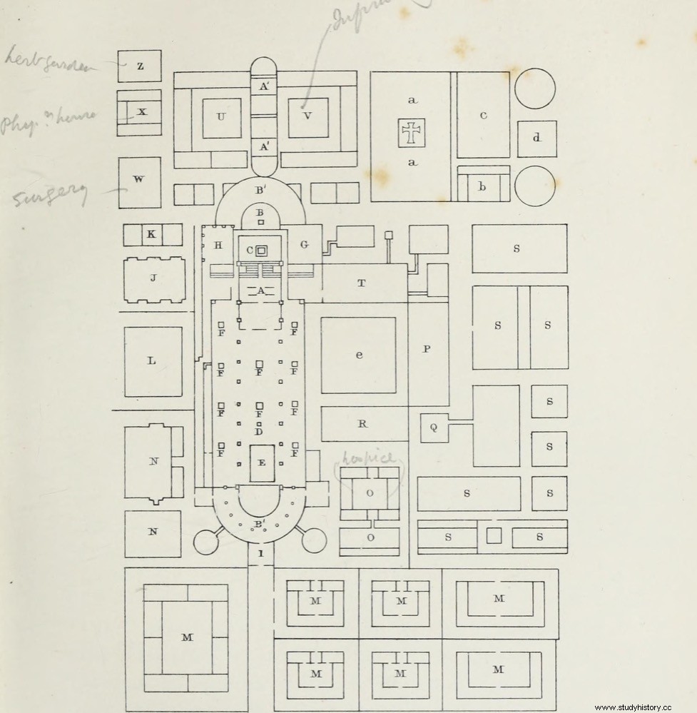
Among the treasures it keeps is the so-called plane (or plant) of Saint Gall , an architectural plan unparalleled throughout the High Middle Ages and much of the Lower Middle Ages. In fact, it is the only major architectural design to survive between the fall of the Western Roman Empire and the 13th century.
It dates from 820-830 AD, a time when the abbey was under the control of Emperor Ludovico Pío, son of Charlemagne. And in addition to being unique in its kind for a period of about 700 years, it has other interesting peculiarities, such as:it is not known who designed it or why, the project was never built, and the monks used it in the 12th century to write behind the life of San Martín. But there is more.
The plan was drawn on five scrolls sewn together and has dimensions of 113 by 78 centimeters. It represents a monastic complex drawn in red ink, with its abbey church, cloister, abbot's house and monks' quarters, school, guest house, pilgrim's house, novitiate, stables, kitchens, workshops, brewery, infirmary, cemetery, orchard and gardens. According to calculations made by experts, the projected complex could house about 110 monks, 115 visitors and 150 artisans and peasants.
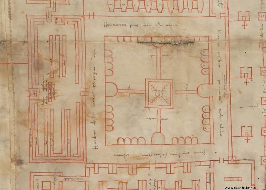
More than 300 inscriptions describing the functions of each of the buildings were added in brown ink. They were made by two different scribes and, by comparison, it has been possible to determine that they were monks belonging not to Saint Gall but to the nearby (about 52 kilometers to the northwest) Reichenau monastery, founded in 724 and located on the island of the same name in Lake Constance (in the present German state of Baden-Württemberg).
Furthermore, one of the scribes has been identified as the monk Reginbert, the Reichenau librarian who authored the Library of Symbols codex around 820.
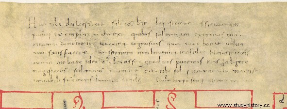
The plan bears a dedication, to Abbot Gozbertus or to a monk of the same name who lived in the monastery at the time:
There are two theories as to why the plan was drawn. Some historians, such as Walter Horn and Ernest Born, believe that it is a copy of the original plan created at the court of Ludovico Pío. The monarch would have wanted to establish a network of monasteries in his empire, thereby giving the guidelines of how they should be built in accordance with the Benedictine rule.
Others, such as Werner Jacobsen, Norbert Stachura and Lawrence Nees, maintain that the plan is an original work, made in the Reichenau monastery, perhaps commissioned by the abbot of St. Gall, who wanted to build a new church for his abbey in the 820s. They are based on the fact that the parchment shows marks of having used compasses, and on the fact that changes and alterations made during the delineation process can be seen. In fact, it is known that the works to build a new church began in the year 830.
Reichenau was at that time a royal monastery, dependent on the crown, while St. Gall belonged to the Bishop of Constance. In addition, in the lower part of the plan, according to Alfons Zettler, a great royal palace can be seen, something only present in great royal monasteries such as Saint-Denis.
However, it does not appear with that name, but labeled as guest reception house . Zettler believes that the existence of another building, a hospice for pilgrims and beggars, on the other side of the church, suggests that the first was actually intended to house a visit from the monarch.
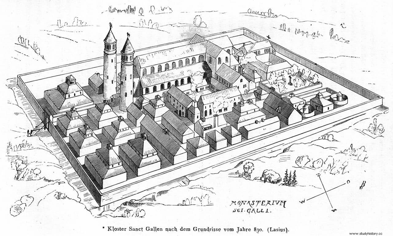
The scale at which the plan is drawn is also not very clear, whether it is the same scale for the entire set or some elements are on a different scale. 1:192 is generally accepted, which would correspond to 1/16 of a foot. What the experts do agree on is that there is a differentiation of spaces according to social status.
Lynda Coon found that the northwest area includes buildings reserved for secular elites, while the southwest corresponds to the lower classes. On the other side, the sacral zone is also divided, with the northeast and southeast for the monastic elite, and the further east and south for the novices.
Today it is considered that the plan does not show the layout or plan of a specific Carolingian monastery, and that the monastery complex depicted was not intended to be built in St. Gall or anywhere else. It would be a vision of how a great royal abbey should be, conceived in the particular political situation of the Regnum Alamannorum between the abbeys of Reichenau and St. Gall in 829-830.
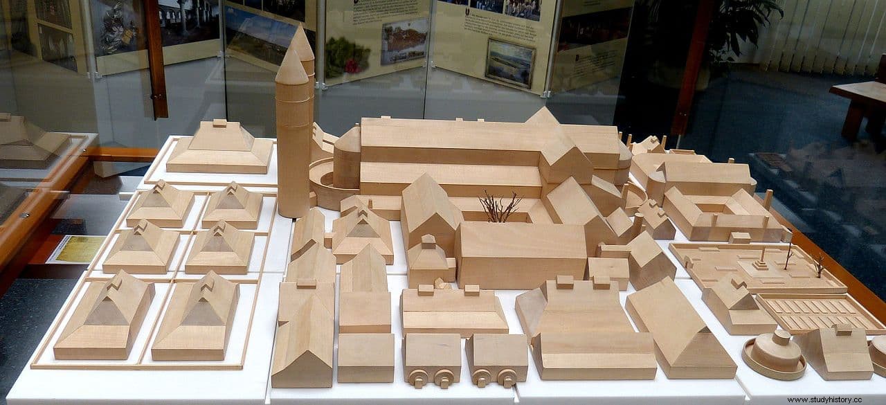
A few years ago a group of enthusiasts created in Meßkirch, Baden-Württemberg, very close to Lake Constance, a construction project that aims to carry out what is represented in the plan of St. Gallen. To do this, they use techniques and tools of the time, and since 2013 the place has been open to the public as a theme park (with restaurants, accommodation and others), in order to finance the works. On its official website there is a version of the plan in which you can see what function each building had.
