An animated map of Europe showing the course and changes of country borders on the European continent. The animation shows the course of borders from 400 BCE. up to modern times. This is how the borders of countries in Europe have changed over the centuries.
State borders in Europe
Another interesting video worth watching has appeared on the web. This time someone tried to create an animated map of Europe in the form of a film, which would show the changes that were taking place year after year. In this way, a nearly twelve-minute film was created showing the shaping of the borders of individual European countries since 400 BCE. Of course, the scope of the study is extremely extensive and complicated, therefore it was not possible to avoid all errors. The preparation of the film also required some simplification. For example, Poland in the times of the division into districts was presented as one state, although in fact in many places we were dealing with independent, separate states. The same is true for other feudally fragmented areas.
Interesting fact, next to the map there is also a schedule with the then population of individual countries.

The borders of European countries in 1295 - Source:youtube / Cottereau
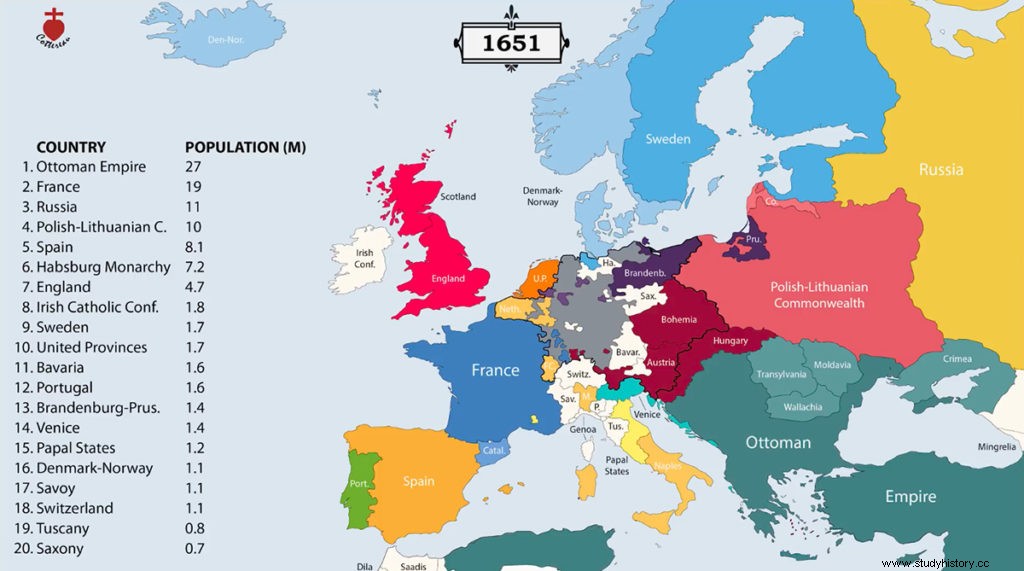
The borders of European states in 1651 - Source:youtube / Cottereau
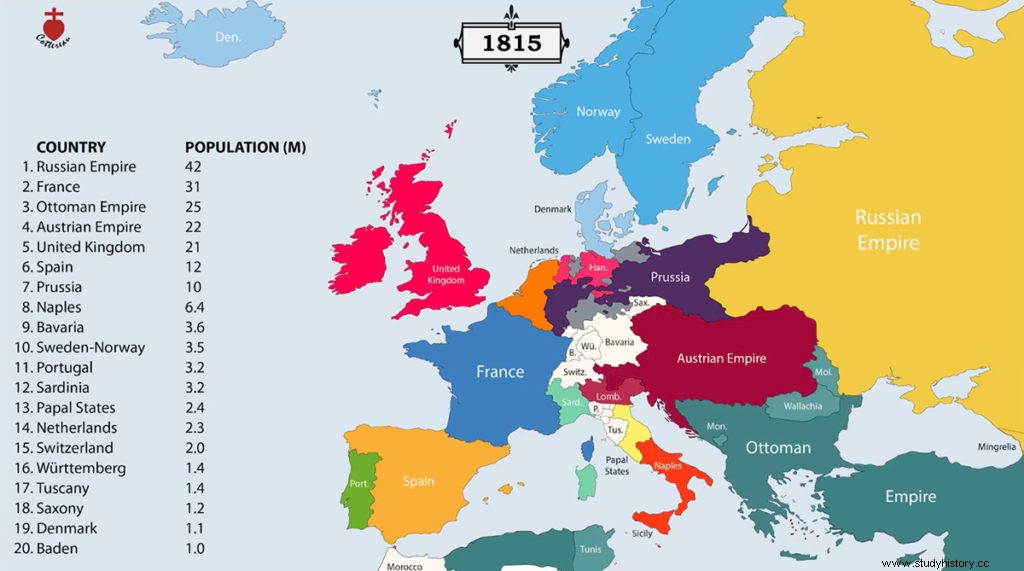
The borders of European countries in 1815 - Source:youtube / Cottereau

This is how the borders of countries in Europe changed year after year, 1934 - Source:youtube / Cottereau
The rulers of the countries of Europe
Another video was also posted on the author's channel of the above video. The film was made in a similar convention, but this time the rulers were marked on the map instead of the names of individual political entities. I am posting a video below as a supplement.