Let us admit the 16th century as the beginning of the discovering policy of Spain as we know it today. Or better, the end of the reign of the Catholic Monarchs considered as the implantation of Modernity with the denomination of Spain, after the union of Castile, Aragon, Granada and Navarra. We can accept this principle even if it is not strict on the chronology.
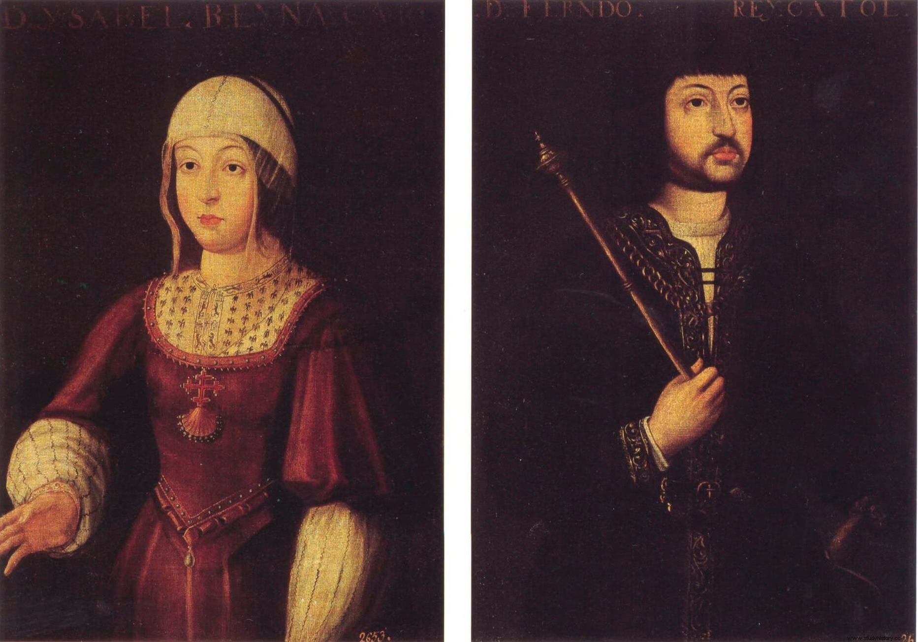
But today we have to talk about Discoveries with capital letters, although it was necessary to define a beginning and justify it. For us, the origin of the Spanish discoveries was the same impulse that maintained the Reconquest and that continued in 1492. It is not trivial that it is this year, key in the History of Spain, the one that contains the delivery of Granada in January and the discovery of the “Mundus Novus” in October.
It is true that there is traditional historiography listing remote and abstract causes, such as the cut off of trade with the East by the Turks, but in the Iberian Peninsula at the end of the 15th century the effect of the fall of Constantinople affected him little. His was the Reconquest. When this ended, the illusion of creating a united peninsular state continued and specific circumstances helped to carry out an expansionism across the Atlantic to the marriage policy of Isabel and Fernando. It is in this historical framework that we must place Christopher Columbus, a key man in carrying out an Atlantic policy, first Castilian but now Spanish, with the good Queen Juana.
Christopher Columbus ferment of Atlantic expansionism
The temptation to attribute only to Spain the merit of the discovery of land beyond the ocean is very old, the chronicler Fernández de Oviedo already did it, granting it to Argantonius, king of Tartessos, with such as to detract from the Genoese. However, we must affirm that it was the presence of Christopher Columbus in the court of the Catholic Monarchs, in Alcalá de Henares at Christmas 1485-86, which caused the birth of interest in the Atlantic theme, especially in the recently born Isabel .
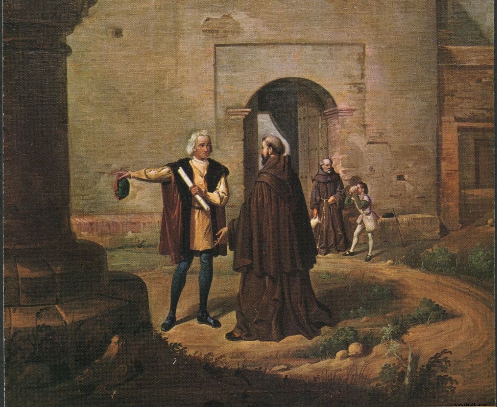
What did you see in Columbus and his proposal on her way to East by West the Castilian queen? Was Isabel really interested in the spice trade with the East? The answers must be given by the reader. Our opinion is that the needs of the queen were more immediate and close. We believe that it was the need to recover aspects lost in the Treaty of Toledo-Alcaçovas (4-IX-1479), where, in order to secure the throne in Castile, it had to give up the Castilian naval presence in the Atlantic, saving only the Canary Islands. (J. Varela 1996).
This political situation could well have been what led to the acceptance of a “quídam” like Columbus in a court like the Castilian one, which was immersed in the war to recover Granada. Of course, he did not promise to act immediately, but left the Genoese waiting, giving him a support salary. His time would come.
And the moment came seven years later, just as Granada fell. Even at the same time, since the last days of December 1491 Columbus was in the Santa Fe camp negotiating the conditions of the future trip. And Christopher Columbus obtained "in extremis" an approval that meant that at the beginning of January, in the triumphal entry into Granada, he was present there. With this royal decision to accept the plan of the Genoese to open a commercial route to the Orient through the Atlantic, we consider that the policy of Great Spanish Discoveries begins.
M a rtín Alonso meets Columbus and they associate
It would be difficult to justify in the correct Spanish History the absence of the Pinzón in the discovery event, for this reason we will now remember his participation in the preparations of the first trip. Even his activity in the restless days of D. Cristóbal in his vain attempt to recruit ships and men.
We know that Martín Alonso was in Italy in the first months of the year 1492, on the way back from the trip he will meet Christopher Columbus. We do not know the exact time, but to place it, it was most likely spring. Witness Rodrigo Prieto el Viejo says about this encounter, in response to the third question of the lawsuits:“ Christopher Columbus came to this town (Palos) to go to the Indies with a provision from their Highnesses of the Catholic Monarchs and who stayed in the monastery of La Rábida for many days and who worked to make his army and could not find people and who agreed with the said Martín Alonso Pinçon and they made their conveniences . ”
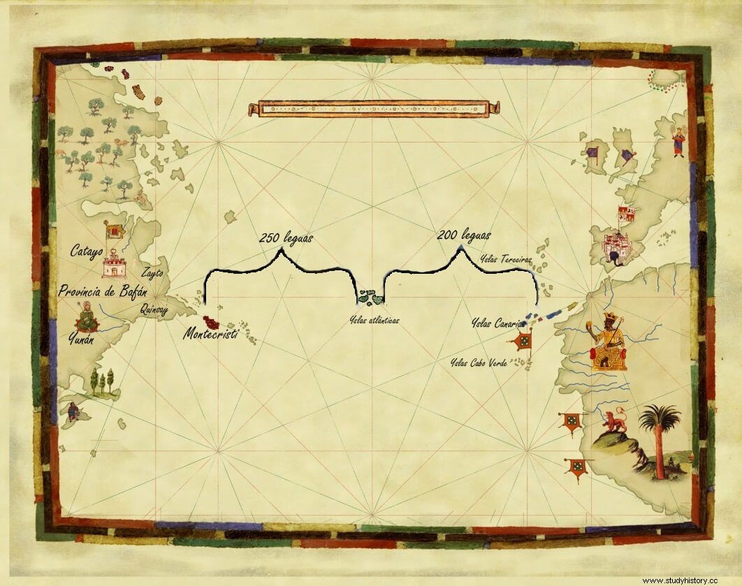
We accept this statement as fundamentally valid on the moment of the encounter between Colón and Pinzón, and when and how both discussed mutual aid. This idea is commonly accepted, even by a character as little inclined towards the Pinzón as Fray Bartolomé de las Casas.
Item more, Las Casas provides even more data on this first relationship and writes about Pinzón:“One was called Martín Alonso Pinzón and he was the main and richest and most honorable… with whom Christopher Columbus began his talk, begging him to go with him on that trip and take his brothers and relatives and friends, and without a doubt it is to be believed that he had to promise something because no one moves but for the interest and usefulness of him”. Following the reading of this chapter, Las Casas says “Martín Alonso Pinzón lent Christopher Columbus half a story (500,000 maravedís).”
It seems that Columbus and Martín Alonso were introduced to the Rábida friar Juan Pérez, serving as a connecting link between the two. This management made possible a business conversation in which both parties agreed to make a verbal partnership to carry out an Atlantic expedition, whose benefits would be "to the party" according to the custom of the seafarers, regulations that they knew and of which, without a doubt, they had experience (J.Varela 2005).
The voyage of discovery and the beginning of the confrontation with Portugal
After the conversations between the two characters, Columbus and Martín Alonso Pinzón, the organization of the trip was easy and on August 3, 1492 the flotilla set sail from the Saltés River in Huelva . A few days through known waters would take them to the Canary Islands, where they were going to spend almost a month engaged in small naval arrangements and in leisure and love affairs between Columbus and Dª Beatriz de Bobadilla.
Finally, on September 8, between La Gomera and Tenerife, Columbus orders a westward course, beginning the journey to the depths of the Atlantic, fulfilling what was ordered by the Kings (J. Varela. M. Leon 2003). It was what was officially stated in the ordinances to avoid confrontations with Portugal.
The trip was very pleasant, so much so that it was subject to riots on board, as it dragged on over time, there was no land to be seen and the winds always blew in favor, which made fear the sailors in the impossibility of returning. In this growing unrest among the men, Martin Alonso was the one who brought sanity, appeasing them and saving the authority of Columbus, who was determined to maintain a fixed course towards the West.

Finally, after the third mob uprising , Martín Alonso addresses Columbus asking him to set a point of return, put a solution to an endless journey. Columbus requested a few more days and accepted the change of course to the Southwest, which led to the discovery of the island of Guanahaní on October 12. Columbus had achieved his title of Admiral and a respect among men that would last him until November 22, the date of separation, but in the meantime he enjoyed command and direction of the discoveries among a sea of islands that were difficult to identify. The Genoese's spirits fell when he saw how the men and cultures that he saw little or nothing had to do with those of Cathay and Zipango. Rather, they were Paleolithic tribes with whom trade was difficult and he only saw in them a possible source of slaves.
At the end of October the armadilla discovers a wide coast and on November 2 Columbus goes ashore, he was in Cuba and the width of his coast makes him think of land sign. He sends inland an embassy of three wise men in languages to know the culture of the inhabitants of this land, they only discovered the use of tobacco and little else. Back on the coast, anxiety rises among the Castilian men, but especially among Columbus, who wants to identify these shores with those of Asia.
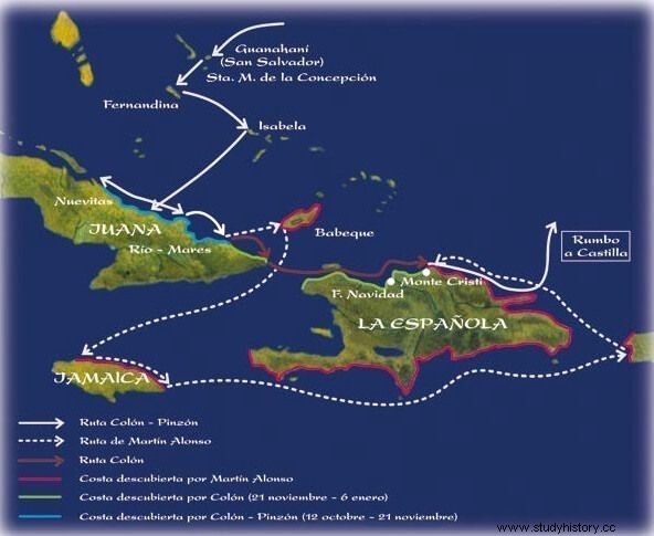
It is at this moment of doubt that the separation of ships. It was on November 22 that Martín Alonso, with the desire to discover Babeque, an island that the tongues said was rich in gold, set sail to the southeast and since the other two ships could not follow him, night fell and the next day the ships did not they were sighted The separation had been consummated and will last until January 6, 1493.
During these 40 days Columbus and Vicente Yáñez Pinzón sailed north of Hispaniola to Monte Cristi, and on December 24 they lost the ship Santa María, which ran aground on the coast, in the land of the cacique Guacanagari. Few geographical discoveries had been made by both ships, but they did make contact with the natives, and especially with their chief Guacanagarí, with whom they established a certain degree of communication.
The loss of the ship was probably a big problem, as he did not have enough ships for the return and was forced to leave 40 men ashore. But it was also a little over a month of coexistence, almost forced with the natives, which made them have some information about each other that would be useful in the future.
Meanwhile, Martin Alonso mistaking the path to follow the armadilla, down the strait between Cuba and Hispaniola discovering Jamaica. Not finding his companions, he sailed around the Hispaniola Island to the South East and circumnavigating it appeared smooth sailing from the East on January 6, giving news and rejoicing to the Spaniards who were with Columbus. The future of returning to Spain was more certain, since more people could be accommodated in both caravels. But all? Only those present will know this question, especially Columbus. Was he interested in leaving the 40 already chosen there, to force himself to return? The truth is that the return was made, allocating the 40 in a defensive tower built for that purpose, with precise recommendations for coexistence with the natives and survival orders.
On Thursday, January 17, heading northeast, both caravels began their return journey. Navigation was difficult, having to go overboard and rising in latitude until it was possible to catch the jet stream that came from the Northern Hemisphere to Europe. Martín Alonso set the course with the Pinta and his brother Vicente followed him in the Niña, Columbus was in this small caravel, in theory as admiral of the flotilla, but he had lost his ship, an important fact among the sailors. Q>
A month later, on February 15, they sight unidentified land. They spent three days between storms trying to find out what those islands were, until identifying them with the Azores.
As of Sunday the 17th the caravels separate, while Columbus and La Niña disembark and have problems with the resident Portuguese. La Pinta weathering the wind manages to continue sailing towards the Northeast and in a few days it will arrive in Bayonne. The date is imprecise, but between February 23 and 25, Martin Alonso would arrive at the Galician port, fulfilling the order that they should return to a Castilian port.
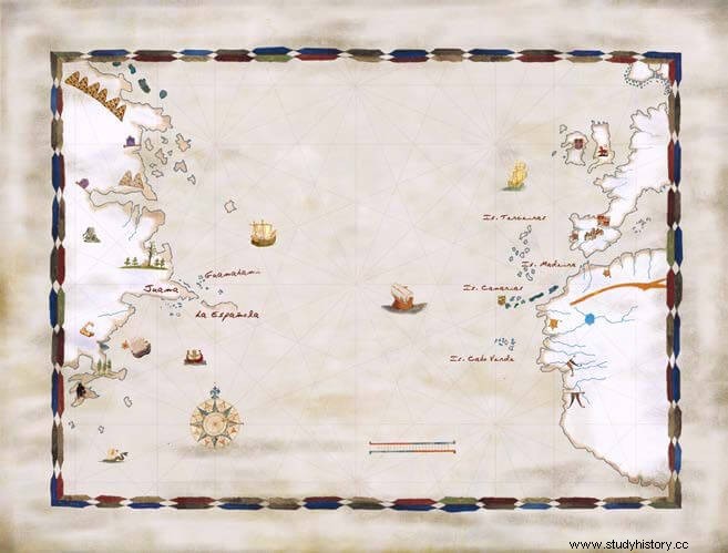
Martín Alonso Pinzón immediately sent an email to Barcelona informing the king and queen of his arrival and sending them cartographic and literary information. We believe it would be something similar to the following drawing:
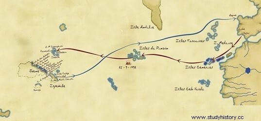
By this time, Columbus had managed to free himself from the Portuguese and set sail for the peninsula where, after new storms, it would arrive at Roca de Çintra on March 4, Monday. With the arrival in Lisbon of Columbus, the voyage of discovery had come to an end, all that remained was for both caravels to return to the port of departure, Palos, as ordered.
But, the Admiral's arrival in Portugal and his interview with King John II in the Valley of Paradise, will generate a political problem whose origin was in the Treaty of Alcaçovas (4-IX-1479). The Lusitanian president questioned Columbus with the intention of knowing where the land they came to visit was located. Even the Indians who came with Columbus were asked by signs what their homeland was, to which they answered by drawing a map on a table, using beans that simulated the islands.
We can see how the results of these interrogations, during the 9-day stay of the Spanish ship in Lisbon, revived old family tensions resolved in Alcaçovas, and which were based on the possibility of that the newly arrived Spaniards had discovered in geographical areas that Alcaçovas had reserved for Portugal. This political approach is confirmed by the sending of two Portuguese ambassadors to Barcelona, where the King and Queen of Spain were, claiming such a possibility.
Thus, we consider that it was precisely the return of Columbus to Lisbon and the success of his mission that triggered a stage of enmity between Castile and Portugal.
Barcelona, city of political decisions derived from the Discovery of America
Both captains of the expedition to the Indies were already back in the Peninsula and had to return to the port of departure, as ordered. This event occurred on March 15, the day that both caravels arrived at Palos de la Frontera and, while the Pinzón family hid, since Martín was very ill and died shortly after, Colón began his trip to the Court with the spirit of a winner. , which made his trip to Barcelona very slow, despite the fact that the king and queen had written to him ordering his rapid presence.
Finally, the triumphant Genoese arrived in Barcelona on April 18, 1493. The monarchs received him as he deserved, and D. Fernando even left home for the first time after his attack, and placed Columbus at his side to show the esteem in which he held him. The monarch maintained the protocol before the Genoese from whom he withdrew the information of the trip, as if it were the first he had. It was at this time that Columbus had to show documentation of his expedition showing that he had been successful, as agreed in the capitulations of Santa Fe.
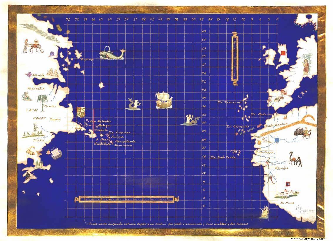
We do not know the exact terms of these conversations, but the following cartographic drawing can help us understand Columbus's point of view about the place where he had arrived.
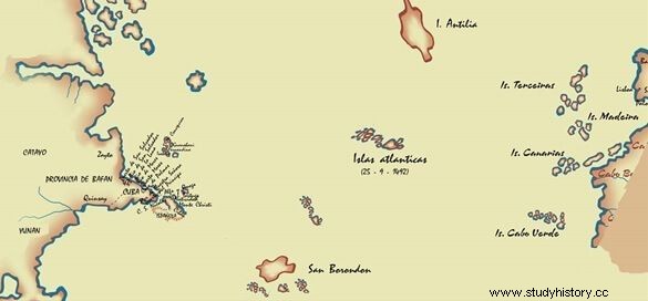
This Columbian information about making the trip to East by West reaching Asia itself, was questioned by the monarchs and their advisers, since we have already anticipated that they had news of this trip through the mail of Martín Alonso Pinzón who had arrived in Barcelona the week of March 6. A month and a half before Columbus' report, he had proposed a voyage with this profile.
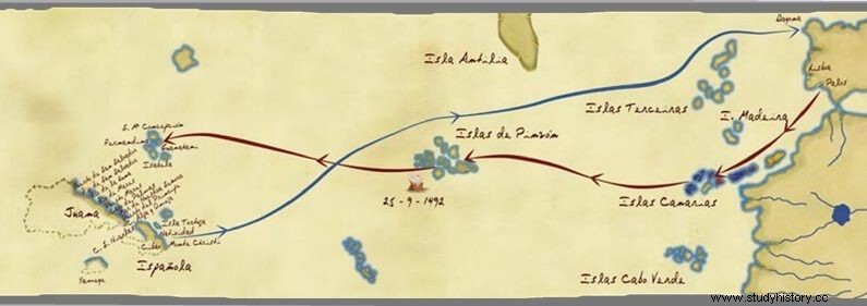
Image very different from the one we saw presented by Martín Alonso, who drew a discovery of islands, while Columbus confirmed the arrival in Asia. Let's see these differences in both portolans.
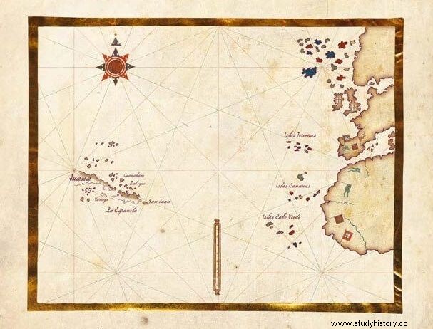
With the differences in the approaches of both captains in the mapping of the trip, to which was added the presence of the Portuguese ambassador (King John II sent Rui de Sande, on 5 of April 1493, to the Spanish court arriving in Barcelona before Admiral Columbus) claiming for his country the lands discovered for having been carried out in the area of influence determined in Alcaçovas as Portuguese, caused solutions to be focused in a serious way . We must note that Spanish diplomacy was already in operation in Rome before Pope Alexander VI, requesting a concession bull for the islands discovered by Martín Alonso Pinzón, and that it had been weeks in advance (J.Varela Tordesillas.1996).
This data explains the speed in the signing of the papal bulls in May, a fact that we always wondered how it was possible, if there was no material time between the arrival of Columbus in Barcelona, the statement of the problem and the signing of the bulls Inter Coetera of May 3 and Inter-Coetera II of day 4, correcting the previous one. The solution is that the Spanish kings had been aware of the discovery since the beginning of March due to Pinzón's report.
Thus, we see in these days of late April and early May that an interesting three-way international dynamic is taking place in Barcelona:the negotiations of the Spanish monarchs with the Pope, the presence of the Portuguese ambassador claiming the discoveries of Columbus for Portugal for having been made in the area assigned to Portugal in Alcaçovas and the scientific interrogation of Columbus about what he had discovered, where he was and how to proceed.
At the same time, Fernando knew of the importance of the fact confirmed by the international claims and, with the help of his trusted man, Luis de Santangel, wrote a letter announcing to all Europe the discovery. This letter is printed in Barcelona at the house of the printer Pere Possa, by whose name the document is known (J. Varela. Disclosure Disclosure . Alcalá de henares Silex. 2016).
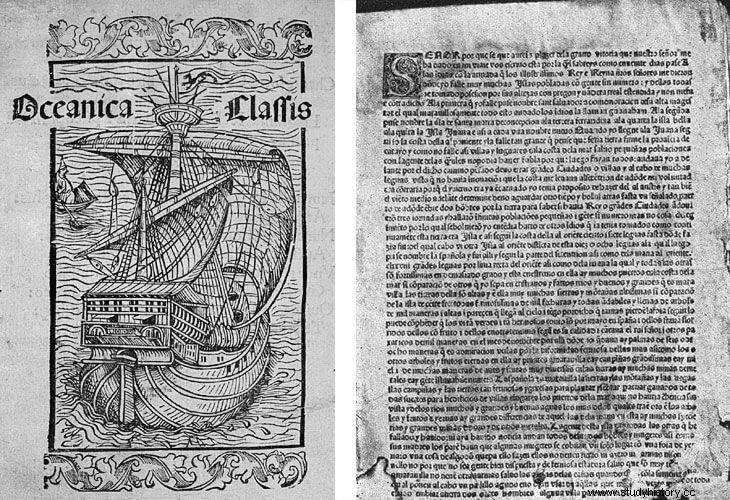
The solutions to these approaches were negotiated with the Pope achieving the purpose; although, Alexander VI asked to know where to put the limit of the concession so as not to offend Portugal. With Portugal things became very tense, the Vizcaya navy was even ordered to go to the Mediterranean to deal with the Portuguese ships, but finally a period of negotiations or waiting was achieved that ended with the Treaty of Tordesillas. With Columbus it is decided to organize the second voyage so that he can check where he had really arrived.
The Journey of Confirmation, the Bulls and the Treaty of Tordesillas
The three events announced in the title unfolded in unison, hence its difficulty. The Hispanic monarchs needed papal permission, by means of Bulls, to have legality in some territories that they did not know where they were, so it was necessary to make a second trip with Columbus; trip that Portugal did not like and was willing to prevent it.
The first movement in time was the request to Pope Alexander VI for a bull that would guarantee ownership of what was discovered, to which the Pope agreed, but there was a problem; put physical limits on the request. It would be the same one who created the problem, Columbus, who in a courier letter from Barcelona on September 5, 1493, exposed the idea of the Raya to the Catholic Monarchs. The monarchs accept the approach communicated to the Pope who is going to consider it, although consulting the Portuguese authorities for the solution of the line.
In another order of action, the Spanish kings decided to organize a great second expedition for Columbus, and put Juan Rodríguez de Fonseca, a young man from Toresa, a prominent university student, at the head of the organization. with advanced knowledge of cartography and naval sciences. This character will be, in a few years, the best connoisseur and responsible for everything related to discoveries and trade with the New World.
The Portuguese do not react aggressively to the second voyage of Columbus, waiting for what comes out of the papal mediation. Rome has raised the issue of drawing a line from North to South passing through the archipelagos of the Azores, the Canary Islands and Cape Verde, which would serve as a separation between the areas of naval influence between Portugal and Castile. Portugal does not admit it, because it would be locked up against Africa, unable to sail to the South by having to build the big rail. This reason contemplated by the Pope admits it and places the line 100 leagues to the west of the archipelagos, to leave a greater navigation corridor to Portugal on its route to the South.
Meanwhile, the second voyage of Columbus has been prepared, and on September 25 the 17 ships set sail from Cádiz, which with Antonio Torres in command of the crew, had as their mission map the place discovered on the first trip and also populate. Farmer families from Zamora and from other places had embarked for these two missions, up to a total of 1,500 people for the entire mission. The Admiral had a royal commission highly recommended by the queen to map the discovered place by degrees.
The royal commands were carried out with alacrity, and Columbus drew a flat chart over where they stood. This information reached Castile with the ships that returned under the command of Torres, and that made it possible for Antonio Torres to deliver the map that portrayed the situation of the discoveries to the kings in Medina del Campo at the beginning of April 1494.
During diplomatic conversations between Spanish and Portuguese representatives, he accepted the solution of drawing a line from pole to pole, with which Castilla had achieved his purpose:to keep what Columbus discovered was located at any latitude. Now we moved on to the second point, which was to place that line, in which Portugal showed more interest.
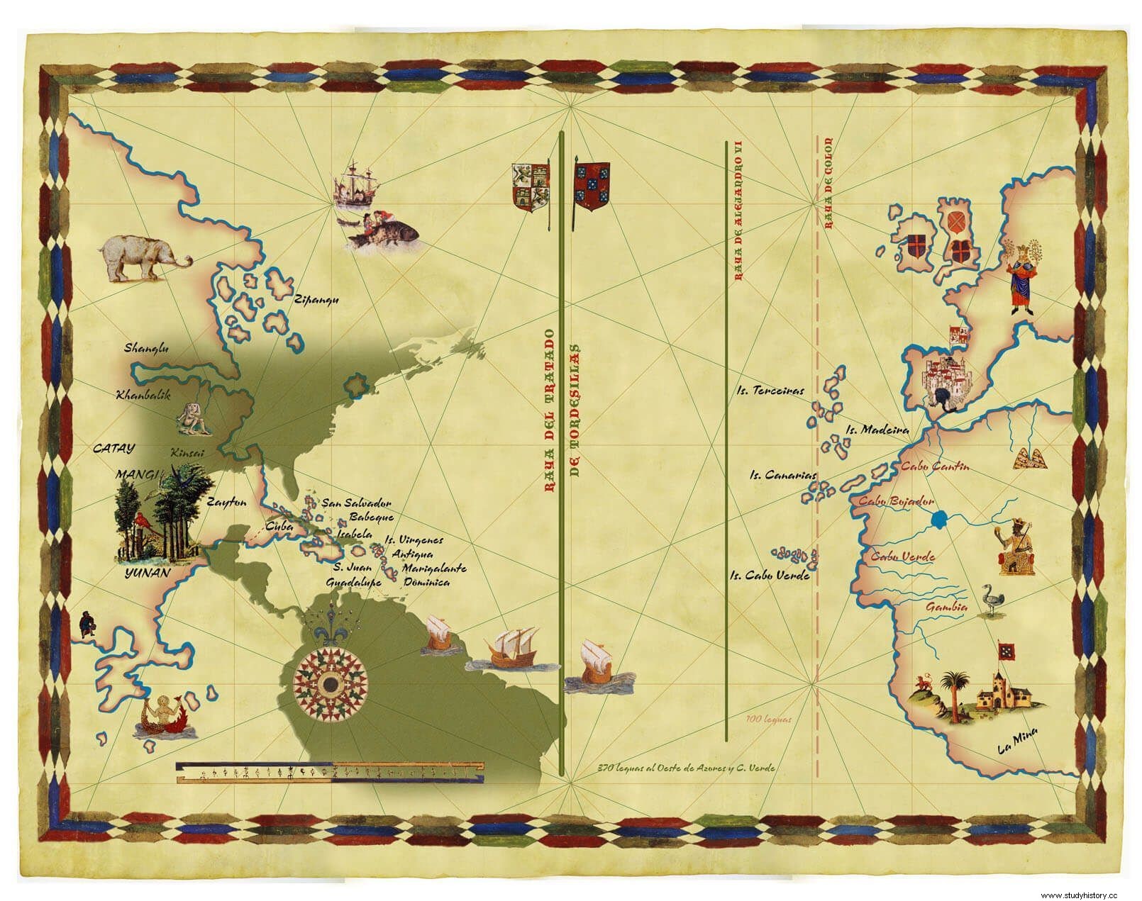
Thus, the conversations focused on the number of leagues away where the line should be located in the Atlantic. This point was not difficult to save for the Castilian commission, aware of the geographical reality, and knowing that if it agreed to the Portuguese request to place it at 370 leagues, there would still be another similar distance until reaching its discoveries, as a safety margin. Therefore, the commission accepted the Portuguese proposal and the Raya de Tordesillas was located 370 leagues to the west of the archipelagos of Cape Verde, the Canary Islands and the Azores.
Finally, the representatives of both monarchies set the date of the signing of this dispute at June 7, 1494, the date on which today the called the Treaty of Tordesillas. On behalf of the Castilian kings, Enrique Enríquez de Guzmán, majordomo mayor of the kings, Gutierre de Cárdenas, commander major of the Order of Santiago and royal accountant, and Dr. Rodrigo Maldonado signed. Representing Portugal signed Ruy de Sousa, his son Juan de Sousa and the magistrate Arias de Almadana.
Likewise, they agreed on a period of one hundred days for the ratification of the Treaty. The Castilian kings endorsed it on July 2, 1494 in the city of Arévalo, and the Portuguese king, Juan II, signed it on September 5 in the city of Setúbal. The definitive documentation drawn up by both delegations is kept in the Archivo General de Indias in Seville (Spain) and in the Torre do Tombo National Archive in Lisbon, Portugal.
The very brief enumeration of important historical events, which occurred in this short space of time that we have analyzed, allows us to affirm that the origin of the era of great discoveries –which Spain made in the 16th century – it had its beginning in the reign of the Catholic Monarchs.
Jesus Varela Marcos He is Professor of the University of American History at the University of Valladolid, Director of the Center for American Studies-Casa Colón in Valladolid, Director of the Ibero-American Seminar on Discoveries and Cartography, Director of the Journal of Columbian Studies. Our fundamental lines of research are:Christopher Columbus, historical cartography, also dealing with issues such as trade in the eighteenth century, with multiple publications that attest to it.
Bibliography
CEREZO MARTÍNEZ R. (1994) Spanish nautical cartography in the 14th, 15th and 16th centuries . Madrid CSIC.
CHAVES . Alonso of 1983) Mirror of Navigators. Transcription, study and notes by Paulino Castañeda Delgado, Mariano Cuesta Domingo and Pilar Hernández Aparicio, Naval Museum.
CONTI S. (2009) Bernardo Silvano and his cartographic work. Valladolid. Revista de Estudios Colombinos.nº5, pp.63-75.
CUESTA DOMINGO, M. (1992) Cartography in "prose" during the time of the great American discoveries. Madrid. Congress of History of the Discovery (1492-1556). RAE., pp236-279.
FERNÁNDEZ DURO, Cesáreo, (1895) Some unknown works on cosmography and navigation, especially the one written by Alons o of Chaves at the beginning of the 16th century , Madrid, [Printing of the Magazine of Navigation and Commerce].
LEÓN GUERRERO M. (2005) Geographical discoveries of the second Columbian voyage and its reflection in cartography . Proceedings of the International Congress of American History., pp.51-58.
LUZZANA CARACI I.(2009) Al di là di altrove. History of geography and exploration .published by Ugo Mursia Editore.
MANSO PORTO C.(2014) Cartography of the South Sea of the Royal Academy of History and its relationship with the History of the Indies . Valladolid. Journal of Columbian Studies, No. 10pp. 33-44.
PALADINI CUADRO A. (2000) The formation of the modern chart of the world in the 16th century. Monte Buciero nº 4, pp 61-70.
PINHEIRO MARQUES A. FERREIRA DO AMARAL J. (2006). New light on the origins of Portuguese cartography from the two discoveries period. Proceedings of the International Congress “V Centenary of the Death of the Admiral”:Valladolid, May 15-19, 2006 / coord. by Jesús Varela Marcos María Montserrat León Guerrero, Vol. 1, (Christopher Columbus and the discovery of the New World), pgs. 455-484
SECO SERRANO C. (1992) Alonso de Ojeda's journey in 1499:final conclusions. Madrid Congress of History of the Discovery (1492-1556). RAE.pp11-36.
VARELA MARCOS (2018) Hispano-American Cartographic Monument. Historical Atlas of the Discoveries, XV and XVI century. Valladolid (SIDC).
———– (2017) The Mexican coasts in the first printed map of America . Humanities magazine:Tecnológico de Monterrey Nº. 19, pp. 145-168.
VARELA MARCOS J. (2016) American cartography in Fonseca's will . Journal of Columbian Studies, No. 12, pp. 19-36.
————– (2011.) The organization of the great Spanish discoveries in America . Valladolid City Hall.
———– (2011) Juan de la Cosa : the historical cartography of the Spanish discoveries. coordinate by J Varela. Seville, pp. 61-142
———- (2007) Martín Waldseemüller y su planisferio del año 1507:origen e influencias. Revista de Estudios Colombinos, Nº. 3, págs. 7-18.
———— (2006) La cartografía colombina . Diputación Provincial de Valladolid.
————–(2005) Colón y Pinzón, descubridores de América . Tordesillas (Valladolid) :Instituto Interuniversitario de Estudios de Iberoamérica y Portugal,
———– (2003) El itinerario de Cristóbal Colón (1451-1506) Valladolid.
—————-(1997) El Tratado de Tordesillas en la política atlántica castellana .
Secretariado de Publicaciones e Intercambio Científico, Universidad de Valladolid.
