Between the towns of Melba and Marsing, in the US state of Idaho, there is a huge rock inscribed with a curious prehistoric map.
The basalt rock, about the size of a small car, contains a petroglyph that at first glance appears to be a chaotic array of meaningless strokes and circles.
But in reality it is a map of the Snake River region, in which it is located, with mountains, watercourses, weather indications, and even the location of herds of game animals, and nearby tribes.
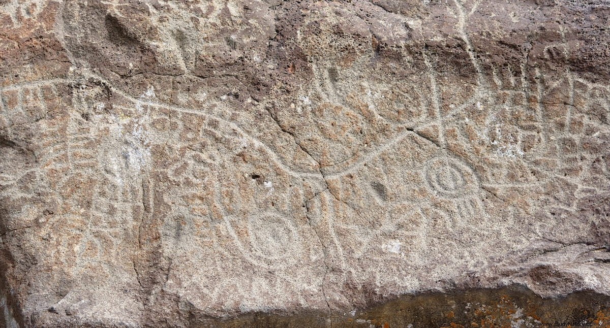
In fact, the entire area is abundant in petroglyphs, making up the Celebration Archaeological Park, in the south of the state. The dating of the carvings is estimated at about 12,000 years old, but there are also some more modern ones, petroglyphs made until the 19th century by the peoples who lived in the area, the Paiute and the Shoshone.
It is precisely to the latter that the creation of the map is attributed, without until now it has been possible to more than theorize about its usefulness as a point of reference for hunting. Some see in it a reflection of the position of the constellations. Others say it shows the migratory patterns of buffalo and other animals.
Some are surprised that the Shoshone could have put all this knowledge out there for everyone to see, instead of keeping it to themselves, so they bet on some kind of relationship with shamanic practices.
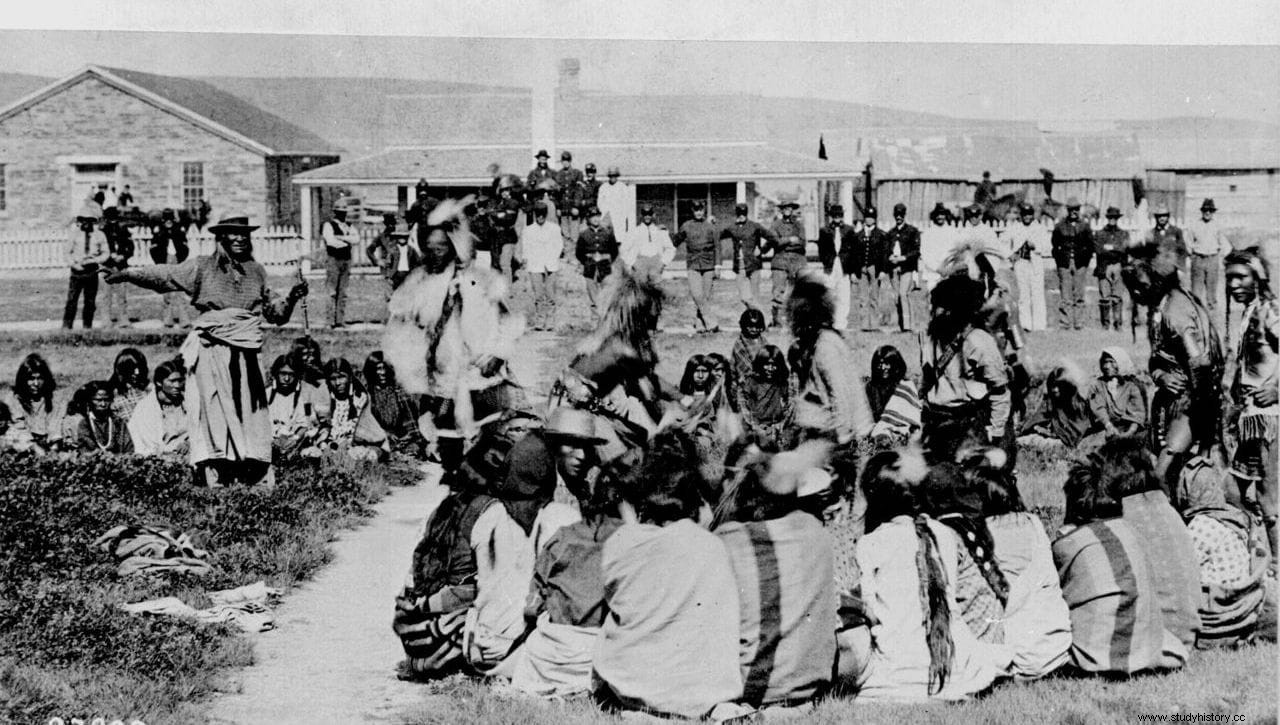
The present-day Shoshone themselves, who share the Fort Hall reservation with the Bannocks, say that it is a map, and the place has great spiritual importance for them.
The Shoshone people (or Shoshoni) are a group of tribes that speak a language of Uto-Aztecan origin, and that inhabited areas of Nevada, Utah, Idaho, Wyoming, California and Oregon. They were divided into four groups, until one of them, the Comanche, formed their own separate tribe. Currently there are only about 12,000 individuals left.

It is unknown who discovered the petroglyphs in 1872, which were practically abandoned until November 2012 when the rock where the map is found, and about 14 hectares around it, were purchased by Canyon County for the creation of the park.