Although the main attraction of Malta resides in its monumental heritage, fundamentally from the Modern Age to the Contemporary, also appearing in the guides, and with capital letters, the abundant megalithic constructions scattered throughout the archipelago.
It is known that this small group of islands began to be inhabited in the Neolithic , probably due to emigration from Sicily, which is why today's visitors have at their disposal a wide range of prehistoric sites of interest dating back seven thousand years.
Of all these sites, one of the most unusual is located in the southwestern part of the main island, sharing the spotlight with a corner of great natural charm:the Dingli cliffs , near Siġġiewi.

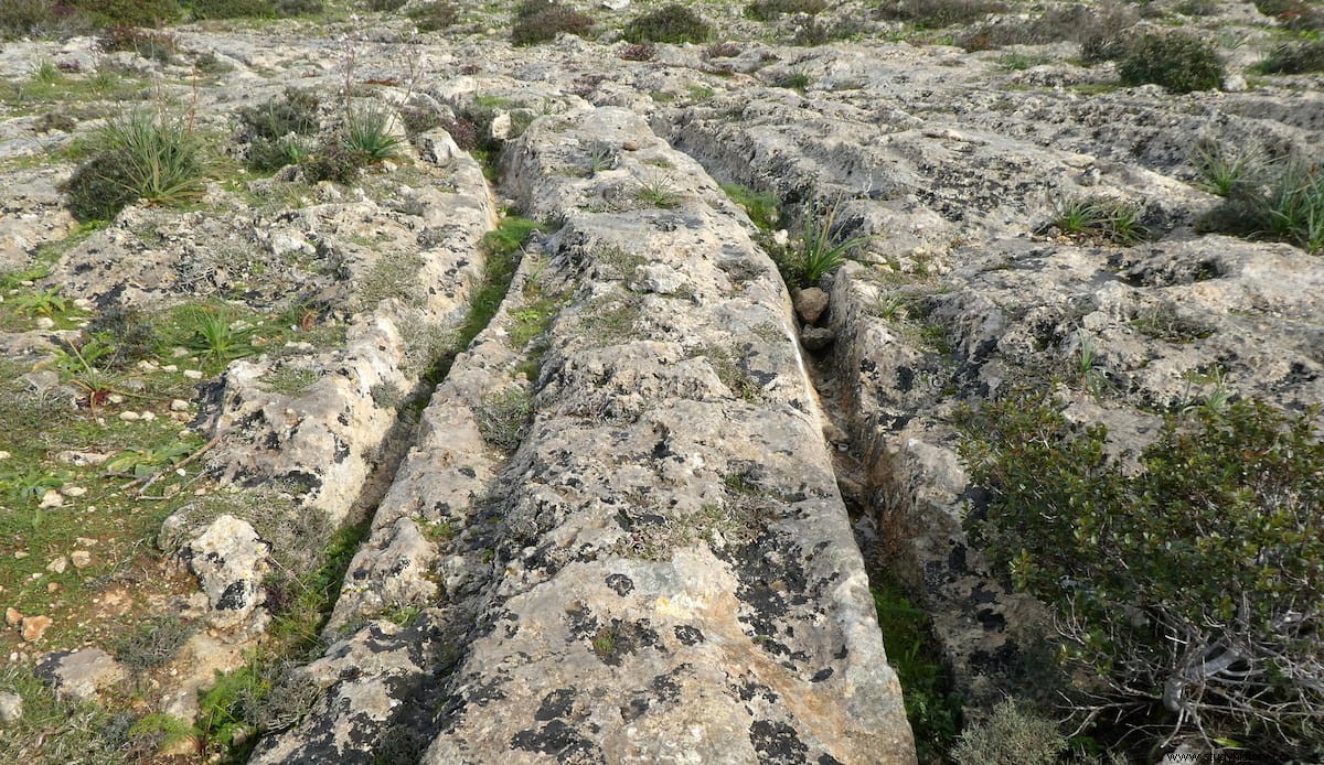
There, in the upper part of these formidable rocky cliffs, the ground appears pierced by a series of strange grooves forming an enigmatic network that would seem easily explained by having been trodden by chariot wheels... were it not for a significant detail:they are on the stone floor .
This fascinating place is called Misrah Ghar il-Kebir , although the British called it Clapham Junction because it reminded them of the set of rails in a London railway station. These marks have been dubbed cart ruts by local people and are found not only here but also in Busewdien, St. Paul's Bay, Naxxar, San Gwann and Bidnija, as well as Sannat on the neighboring island of Gozo. Moreover, there are also in Sicily and Libya. However, the most spectacular, by quantity and concentration , are those of Dingli, which occupy an area of eight hectares.
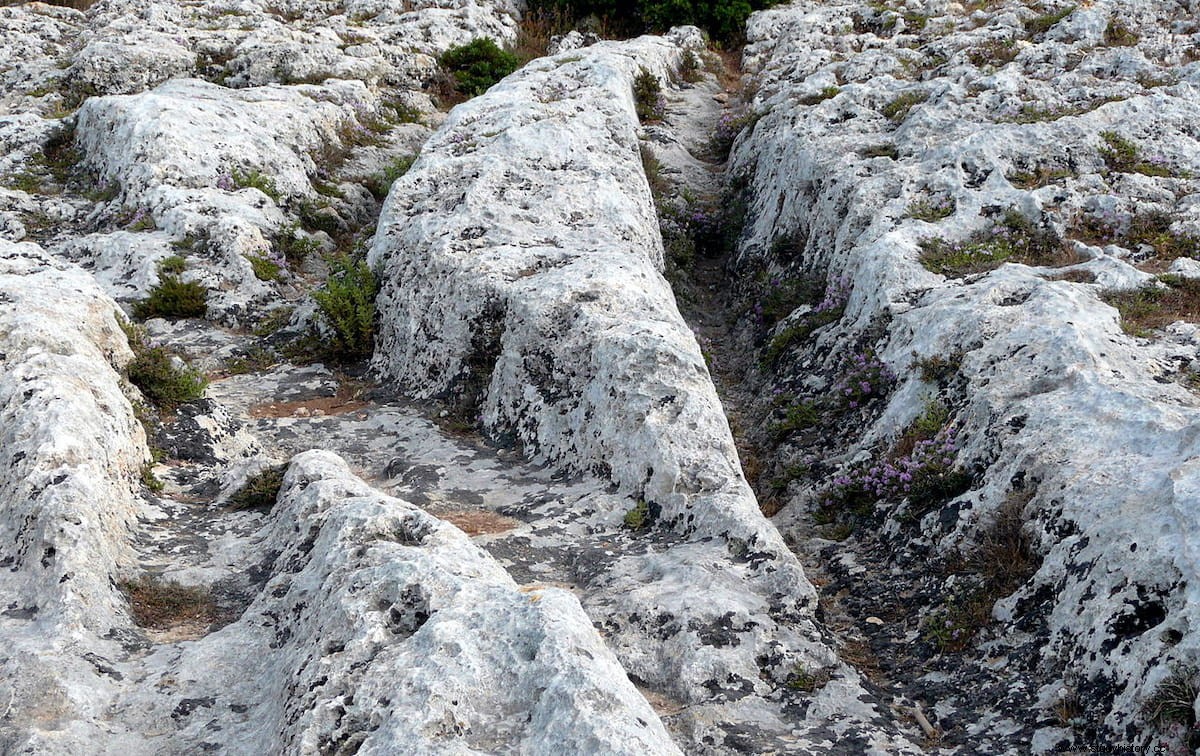
They consist of treads that penetrate up to 60 centimeters on the ground and have a separation between each other of 1.10 at 1.40 meters . They stretch out almost out of sight; sometimes criss-crossing and sometimes ending their path on the edge of the cliff (although some are still under the sea), without making it clear what itinerary they would have, if any.
The big consequent question is what would be the origin and there you can hear theories of all kinds, from the hypotheses of archaeologists to the frivolities of esoteric magazines.
Thus, to cite only the less bizarre proposals , there has been talk of carved rails to move large stone blocks destined for the various cyclopean temples in the vicinity (Qim, Mnajdra), of a peculiar water distribution system for irrigation, of calendrical lines or, simply, of furrows left by transport cars , well with wheels, well sled type. This last option seems to be the most accepted by archaeologists, which leads to another question:how can traces be left on the stone? ?
The answer, it seems, is that the land was soft limestone . A study carried out by Professor Mottershead, from the University of Portsmouth, suggested that the wheels -or skates- would leave deep marks in the upper layer of the ground, scraping the limestone subsoil, and the water coming from the rains and runoff would find channeling through those grooves, dissolving the rock and eroding them further and further.
The continuous passage of cars that would take advantage of those lanes would deepen the notches; It is necessary to take into account the enormous weight that they would have, since the presence in the vicinity of several quarries indicates that they were transporting stone blocks.
In fact, experts believe that there used to be a much larger number of footprints, only they have been lost. They would date from the Bronze Age if you pay attention to those who date the traces around the year 5,000 BC; but others bring the date a little closer to the Phoenician period. . In other words, few certainties.